 vesseltracker.com
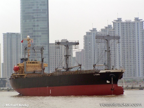
Vessel TAJ IMO: 9010060, MMSI: 620968000 General Cargo Ship
UTC, 41.41134, 41.43077, course: 135, speed: 0
UTC, 41.41132, 41.43076, course: 135, speed: 0
2026-03-22 23:32:21 UTC, 41.41132, 41.43076, course: 135, speed: 0
Live Vessel TAJ Analytics (details, animations, etc.)
Live AIS position: UTC. Near HOPA), updated 2026-03-22 23:32:21 UTC.Find the position of the vessel TAJ on the map. The latter are known coordinates and path.
marine traffic ship tracker show on live map
The current position of vessel TAJ is 41.41132 lat / 41.43076 lng. Updated: 2026-03-22 23:32:21 UTCCurrently sailing under the flag of Comoros
TAJ built in 1991 year
Deadweight:
10053 tDetails:
Last coordinates of the vessel:
UTC, 41.41136, 41.43077, course: 132, speed: 0UTC, 41.41134, 41.43077, course: 135, speed: 0
UTC, 41.41132, 41.43076, course: 135, speed: 0
2026-03-22 23:32:21 UTC, 41.41132, 41.43076, course: 135, speed: 0