 vesseltracker.com
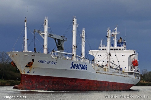
 PRINCE OF SEAS
Current Status
Where is the vessel?
PRINCE OF SEAS is currently in Near KILLYBEGS, based on AIS data received about 2h ago.
Latest AIS update:
Current position: 54.62722° N, 8.43839° W (Near KILLYBEGS)
Average speed (last 7 days): Loading…
Average speed (last 30 days): Loading…
Vessel profile: PRINCE OF SEAS is a Reefer with dimensions m x m.
This page combines live AIS, route history, probable destination signals, nearby traffic, and port activity for practical vessel monitoring.
The current position of vessel PRINCE OF SEAS is 54.62722 lat / -8.43839 lng. Updated: 2026-04-05 21:40:42 UTCNearest reference points:
- 10 nm NE of Belmullet
- Near Tarbert Island
- Near GREENORE
Currently sailing under the flag of Bahamas ![]()
Details:
Live Vessel PRINCE OF SEAS Analytics (details, animations, etc.)
Recent AIS points (UTC):
2026-04-05 15:19:42 UTC · 54.62724, -8.43843 · SOG 0 kn · COG 11°2026-04-05 17:58:43 UTC · 54.62725, -8.43839 · SOG 0 kn · COG 10°
2026-04-05 19:34:44 UTC · 54.62723, -8.43839 · SOG 0 kn · COG 10°
2026-04-05 21:40:42 UTC · 54.62722, -8.43839 · SOG 0 kn · COG 10°