 vesseltracker.com
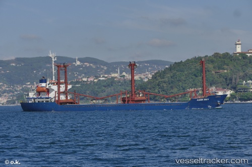
 AMIR BEY
Current Status
Where is the vessel?
AMIR BEY is currently in 26 nm NE of Darnah, based on AIS data received less than 1h ago.
Latest AIS update:
Current position: 33.02141° N, 23.04094° E (26 nm NE of Darnah)
Average speed (last 7 days): Loading…
Average speed (last 30 days): Loading…
Vessel profile: AMIR BEY is a General Cargo with dimensions m x m.
This page combines live AIS, route history, probable destination signals, nearby traffic, and port activity for practical vessel monitoring.
The current position of vessel AMIR BEY is 33.02141 lat / 23.04094 lng. Updated: 2026-04-12 21:28:42 UTCNearest reference points:
- 67 nm S of Kali Limenes
- 85 nm W of Paleochora
- 59 nm W of Paleochora
Currently sailing under the flag of Comoros ![]()
Details:
Live Vessel AMIR BEY Analytics (details, animations, etc.)
Recent AIS points (UTC):
2026-04-12 16:26:19 UTC · 32.61994, 23.83272 · SOG 7.6 kn · COG 309°2026-04-12 17:51:01 UTC · 32.74822, 23.66999 · SOG 8.4 kn · COG 305°
2026-04-12 19:31:53 UTC · 32.90054, 23.41880 · SOG 11.3 kn · COG 299°
2026-04-12 21:28:42 UTC · 33.02141, 23.04094 · SOG 10.5 kn · COG 275°