 vesseltracker.com
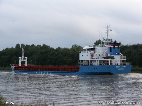
Vessel Wilson Humber IMO: 9017381, MMSI: 314207000 General Cargo Ship
UTC, 36.14710, -9.58735, course: 338, speed: 7.5
UTC, 36.53289, -9.69445, course: 346, speed: 8.7
2026-02-09 07:58:20 UTC, 36.75160, -9.75117, course: 349, speed: 8.9
Live AIS position:
UTC. 42 nm W of Sagres),
updated 2026-02-09 07:58:20 UTC.
Find the position of the vessel Wilson Humber on the map. The latter are known coordinates and path.
marine traffic ship tracker show on live map
The current position of vessel Wilson Humber is 36.75160 lat / -9.75117 lng. Updated: 2026-02-09 07:58:20 UTCCurrently sailing under the flag of Barbados
Wilson Humber built in 1999 year
Deadweight:
4167 tDetails:
Last coordinates of the vessel:
UTC, 35.91277, -9.51027, course: 340, speed: 7.3UTC, 36.14710, -9.58735, course: 338, speed: 7.5
UTC, 36.53289, -9.69445, course: 346, speed: 8.7
2026-02-09 07:58:20 UTC, 36.75160, -9.75117, course: 349, speed: 8.9