 vesseltracker.com
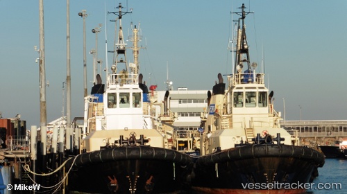
Wilga
Current StatusWhere is the vessel?
Wilga is currently in Near East Devonport, based on AIS data received about 1h ago.
Latest AIS update:
Current position: 41.18503° S, 146.36276° E (Near East Devonport)
Average speed (last 7 days): Loading…
Average speed (last 30 days): Loading…
Vessel profile: Wilga is a Tug with dimensions 12m x 32m.
This page combines live AIS, route history, probable destination signals, nearby traffic, and port activity for practical vessel monitoring.
The current position of vessel Wilga is -41.18503 lat / 146.36276 lng. Updated: 2026-04-19 13:52:27 UTCNearest reference points:
- Near Beaconsfield
- Near LINDISFARNE
- Near Hobart
Details:
Live Vessel Wilga Analytics (details, animations, etc.)
Recent AIS points (UTC):
2026-04-19 10:37:26 UTC · -41.18503, 146.36276 · SOG 0 kn · COG 342°2026-04-19 12:21:40 UTC · -41.18500, 146.36166 · SOG 0 kn · COG -1°
2026-04-19 13:49:27 UTC · -41.18503, 146.36276 · SOG 0 kn · COG -1°
2026-04-19 13:52:27 UTC · -41.18503, 146.36276 · SOG 0 kn · COG -1°