 vesseltracker.com
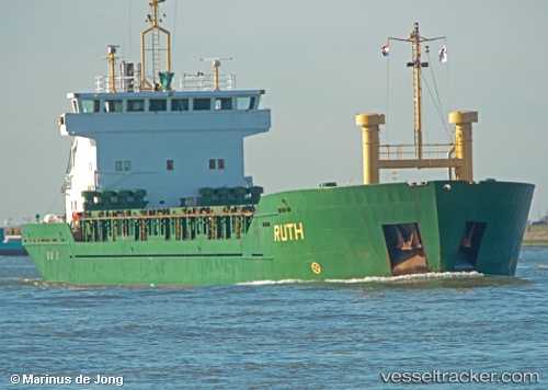
Vessel RUTH IMO: 9021095, MMSI: 577509000 General Cargo Ship
Live AIS position:
UTC. Near TULCEA),
updated 2023-01-10 18:12:01 UTC.
Find the position of the vessel RUTH on the map. The latter are known coordinates and path.
marine traffic ship tracker show on live map
The current position of vessel RUTH is 45.33857 lat / 28.80406 lng. Updated: 2023-01-10 18:12:01 UTCCurrently sailing under the flag of Vanuatu
RUTH built in 1991 year
Deadweight:
5015 tDetails:
Last coordinates of the vessel:
2023-01-10 18:12:01 UTC, 45.33857, 28.80406, course: 257, speed: 0