 vesseltracker.com
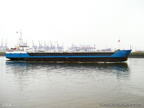
 Bona Safir
Current Status
Where is the vessel?
Bona Safir is currently in Near Gunhildvågen, based on AIS data received about 1h ago.
Latest AIS update:
Current position: 61.58574° N, 4.99602° E (Near Gunhildvågen)
Average speed (last 7 days): Loading…
Average speed (last 30 days): Loading…
Vessel profile: Bona Safir is a General Cargo Ship with dimensions 82m x 11m.
This page combines live AIS, route history, probable destination signals, nearby traffic, and port activity for practical vessel monitoring.
The current position of vessel Bona Safir is 61.58574 lat / 4.99602 lng. Updated: 2026-04-06 01:49:04 UTCNearest reference points:
- Near MALOY
- Near RAUDEBERG
- Near Eikefjord
Currently sailing under the flag of Norway ![]()
Bona Safir built in 1992 year
Deadweight:
2249 tDetails:
Live Vessel Bona Safir Analytics (details, animations, etc.)
Recent AIS points (UTC):
2026-04-05 19:37:02 UTC · 61.58579, 4.99607 · SOG 0 kn · COG 278°2026-04-05 21:27:59 UTC · 61.58578, 4.99603 · SOG 0 kn · COG 278°
2026-04-05 23:55:03 UTC · 61.58580, 4.99602 · SOG 0 kn · COG 278°
2026-04-06 01:49:04 UTC · 61.58574, 4.99602 · SOG 0 kn · COG 278°