 vesseltracker.com
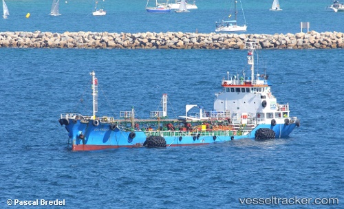
 ECO FRIEND
Current Status
Where is the vessel?
ECO FRIEND is currently in Near Waterport, based on AIS data received less than 1h ago.
Latest AIS update:
Current position: 36.11667° N, 5.30500° W (Near Waterport)
Average speed (last 7 days): Loading…
Average speed (last 30 days): Loading…
Vessel profile: ECO FRIEND is a Oil/Chemical Tanker with dimensions m x m.
This page combines live AIS, route history, probable destination signals, nearby traffic, and port activity for practical vessel monitoring.
The current position of vessel ECO FRIEND is 36.11667 lat / -5.30500 lng. Updated: 2026-04-21 01:45:16 UTCNearest reference points:
- Near Waterport
- Near La Línea de la Concepción
- Near Palmones
Currently sailing under the flag of Gibraltar ![]()
Details:
Live Vessel ECO FRIEND Analytics (details, animations, etc.)
Recent AIS points (UTC):
2026-04-20 22:19:12 UTC · 36.09687, -5.35757 · SOG 5.9 kn · COG 154°2026-04-20 23:52:32 UTC · 36.11718, -5.30561 · SOG 0.1 kn · COG 43°
2026-04-21 01:24:10 UTC · 36.11718, -5.30566 · SOG 0 kn · COG 51°
2026-04-21 01:45:16 UTC · 36.11667, -5.30500 · SOG 0 kn · COG -1°