 vesseltracker.com
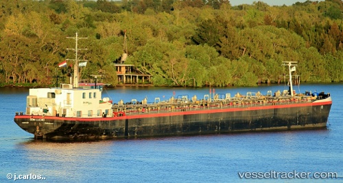
Don Lucho
Current StatusWhere is the vessel?
Don Lucho is currently in 11 nm SW of Ypane, based on AIS data received about 2h ago.
Latest AIS update:
Current position: 25.61425° S, 57.61200° W (11 nm SW of Ypane)
Average speed (last 7 days): Loading…
Average speed (last 30 days): Loading…
Vessel profile: Don Lucho is a Chemical Oil Products Tanker with dimensions 11m x 110m.
This page combines live AIS, route history, probable destination signals, nearby traffic, and port activity for practical vessel monitoring.
The current position of vessel Don Lucho is -25.61425 lat / -57.61200 lng. Updated: 2026-04-18 13:57:19 UTCNearest reference points:
- Near Asunción
Details:
Live Vessel Don Lucho Analytics (details, animations, etc.)
Recent AIS points (UTC):
2026-04-18 07:27:07 UTC · -25.61422, -57.61198 · SOG 0 kn · COG -1°2026-04-18 10:02:06 UTC · -25.61426, -57.61201 · SOG 0.1 kn · COG -1°
2026-04-18 11:44:47 UTC · -25.61426, -57.61201 · SOG 0 kn · COG -1°
2026-04-18 13:57:19 UTC · -25.61425, -57.61200 · SOG 0.1 kn · COG -1°