 vesseltracker.com
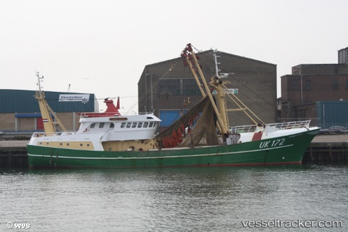
 Sursum Corda Uk 172
Current Status
Where is the vessel?
Sursum Corda Uk 172 is currently in Near Ijmuiden, based on AIS data received less than 1h ago.
Latest AIS update:
Current position: 52.45803° N, 4.57765° E (Near Ijmuiden)
Average speed (last 7 days): Loading…
Average speed (last 30 days): Loading…
Vessel profile: Sursum Corda Uk 172 is a Fishing Vessel with dimensions 37m x 8m.
This page combines live AIS, route history, probable destination signals, nearby traffic, and port activity for practical vessel monitoring.
The current position of vessel Sursum Corda Uk 172 is 52.45803 lat / 4.57765 lng. Updated: 2026-04-22 05:38:03 UTCNearest reference points:
- Near Ijmuiden
- Near IJmuiden/Velsen
- Near BEVERWIJK
Currently sailing under the flag of Netherlands ![]()
Sursum Corda Uk 172 built in 1992 year
Details:
Live Vessel Sursum Corda Uk 172 Analytics (details, animations, etc.)
Recent AIS points (UTC):
2026-04-22 02:17:24 UTC · 52.45801, 4.57762 · SOG 0 kn · COG 232°2026-04-22 03:22:14 UTC · 52.45802, 4.57765 · SOG 0.1 kn · COG 233°
2026-04-22 04:18:09 UTC · 52.45801, 4.57764 · SOG 0 kn · COG 234°
2026-04-22 05:38:03 UTC · 52.45803, 4.57765 · SOG 0 kn · COG 233°