 vesseltracker.com
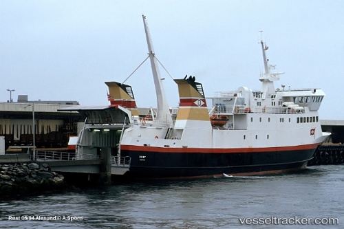
 BALDUR
Current Status
Where is the vessel?
BALDUR is currently in Near STYKKISHOLMUR, based on AIS data received about 2h ago.
Latest AIS update:
Current position: 65.07950° N, 22.72614° W (Near STYKKISHOLMUR)
Average speed (last 7 days): Loading…
Average speed (last 30 days): Loading…
Vessel profile: BALDUR is a Ro-Ro/Passenger Ship with dimensions m x m.
This page combines live AIS, route history, probable destination signals, nearby traffic, and port activity for practical vessel monitoring.
The current position of vessel BALDUR is 65.07950 lat / -22.72614 lng. Updated: 2026-03-27 01:39:07 UTCNearest reference points:
- 13 nm E of ISAFJORDUR
- Near SANDGERDI
- Near RIF
Details:
Live Vessel BALDUR Analytics (details, animations, etc.)
Recent AIS points (UTC):
2026-03-26 20:19:42 UTC · 65.41457, -23.05619 · SOG 15 kn · COG 162°2026-03-26 21:43:54 UTC · 65.09521, -22.73466 · SOG 15.2 kn · COG 158°
2026-03-26 23:30:54 UTC · 65.07954, -22.72621 · SOG 0 kn · COG 93°
2026-03-27 01:39:07 UTC · 65.07950, -22.72614 · SOG 0 kn · COG 93°