 vesseltracker.com
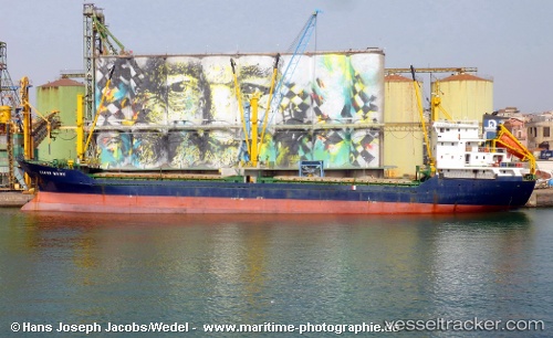
Vessel RECEP KURU IMO: 9040948, MMSI: 352001609 General Cargo Ship
UTC, 40.84336, 14.26661, course: -1, speed: 0
UTC, 40.84335, 14.26656, course: 206, speed: 0
2026-02-08 03:57:55 UTC, 40.84338, 14.26656, course: 307, speed: 0
Live AIS position:
UTC. Near Naples),
updated 2026-02-08 03:57:55 UTC.
Find the position of the vessel RECEP KURU on the map. The latter are known coordinates and path.
marine traffic ship tracker show on live map
The current position of vessel RECEP KURU is 40.84338 lat / 14.26656 lng. Updated: 2026-02-08 03:57:55 UTCCurrently sailing under the flag of Panama
RECEP KURU built in 1994 year
Deadweight:
5048 tDetails:
Last coordinates of the vessel:
UTC, 40.84338, 14.26658, course: 197, speed: 0UTC, 40.84336, 14.26661, course: -1, speed: 0
UTC, 40.84335, 14.26656, course: 206, speed: 0
2026-02-08 03:57:55 UTC, 40.84338, 14.26656, course: 307, speed: 0