 vesseltracker.com
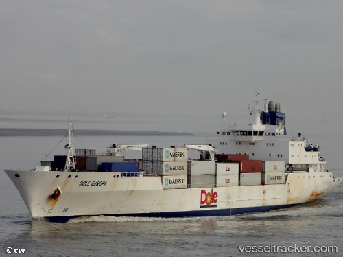
 Dole Europa
Current Status
Where is the vessel?
Dole Europa is currently in Near Pijp Tabak, based on AIS data received about 1h ago.
Latest AIS update:
Current position: 51.26158° N, 4.36402° E (Near Pijp Tabak)
Average speed (last 7 days): Loading…
Average speed (last 30 days): Loading…
Vessel profile: Dole Europa is a Refrigerated Cargo Ship with dimensions 150m x 22m.
This page combines live AIS, route history, probable destination signals, nearby traffic, and port activity for practical vessel monitoring.
The current position of vessel Dole Europa is 51.26158 lat / 4.36402 lng. Updated: 2026-04-07 16:20:22 UTCNearest reference points:
- Near Antwerp
- Near Kruibeke
- Near Kallo
Currently sailing under the flag of Bahamas ![]()
Details:
Live Vessel Dole Europa Analytics (details, animations, etc.)
Recent AIS points (UTC):
2026-04-07 10:20:09 UTC · 51.26156, 4.36406 · SOG 0 kn · COG -1°2026-04-07 11:59:21 UTC · 51.26157, 4.36407 · SOG 0 kn · COG 271°
2026-04-07 14:11:22 UTC · 51.26158, 4.36407 · SOG 0 kn · COG 271°
2026-04-07 16:20:22 UTC · 51.26158, 4.36402 · SOG 0 kn · COG 270°