 vesseltracker.com
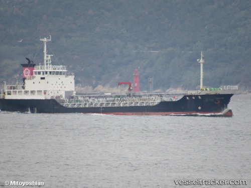
Ryojitsumaru
Current StatusWhere is the vessel?
Ryojitsumaru is currently in Near YOKOTA, based on AIS data received about 1h ago.
Latest AIS update:
Current position: 34.22134° N, 133.35822° E (Near YOKOTA)
Average speed (last 7 days): Loading…
Average speed (last 30 days): Loading…
Vessel profile: Ryojitsumaru is a Chemical Tanker with dimensions 11m x 72m.
This page combines live AIS, route history, probable destination signals, nearby traffic, and port activity for practical vessel monitoring.
The current position of vessel Ryojitsumaru is 34.22134 lat / 133.35822 lng. Updated: 2026-04-18 03:52:19 UTCNearest reference points:
- Near HAKATASHIMA
- Near FUKUYAMA
- Near ONOMICHIITOZAKI
Details:
Live Vessel Ryojitsumaru Analytics (details, animations, etc.)
Recent AIS points (UTC):
2026-04-17 21:33:23 UTC · 33.75667, 132.03667 · SOG 11 kn · COG -1°2026-04-17 23:51:25 UTC · 33.95667, 132.54832 · SOG 11 kn · COG -1°
2026-04-18 01:34:42 UTC · 34.16224, 132.91634 · SOG 13.7 kn · COG 82°
2026-04-18 03:52:19 UTC · 34.22134, 133.35822 · SOG 10.6 kn · COG 74°