 vesseltracker.com
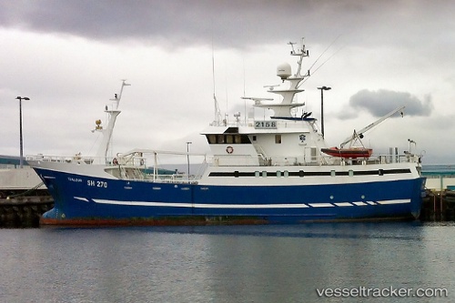
Tjaldur
Current StatusWhere is the vessel?
Tjaldur is currently in Near RIF, based on AIS data received less than 1h ago.
Latest AIS update:
Current position: 64.92160° N, 23.81019° W (Near RIF)
Average speed (last 7 days): Loading…
Average speed (last 30 days): Loading…
Vessel profile: Tjaldur is a Fish Carrier with dimensions 8m x 43m.
This page combines live AIS, route history, probable destination signals, nearby traffic, and port activity for practical vessel monitoring.
The current position of vessel Tjaldur is 64.92160 lat / -23.81019 lng. Updated: 2026-04-02 23:35:32 UTCNearest reference points:
- Near RIF
- Near FLATEYRI
- Near SANDGERDI
Details:
Live Vessel Tjaldur Analytics (details, animations, etc.)
Recent AIS points (UTC):
2026-04-02 18:05:54 UTC · 64.92155, -23.81011 · SOG 0 kn · COG 205°2026-04-02 20:16:32 UTC · 64.92155, -23.81014 · SOG 0 kn · COG 204°
2026-04-02 21:33:13 UTC · 64.92157, -23.81016 · SOG 0 kn · COG 204°
2026-04-02 23:35:32 UTC · 64.92160, -23.81019 · SOG 0 kn · COG 203°