 vesseltracker.com
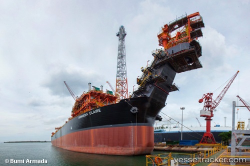
Armada Claire
Current StatusWhere is the vessel?
Armada Claire is currently in Near Tuas, based on AIS data received about 2h ago.
Latest AIS update:
Current position: 1.30062° N, 103.65348° E (Near Tuas)
Average speed (last 7 days): Loading…
Average speed (last 30 days): Loading…
Vessel profile: Armada Claire is a Fpso Tanker with dimensions 42m x 241m.
This page combines live AIS, route history, probable destination signals, nearby traffic, and port activity for practical vessel monitoring.
The current position of vessel Armada Claire is 1.30062 lat / 103.65348 lng. Updated: 2026-03-28 05:54:37 UTCNearest reference points:
- Near Tuas
- Near JURONG ISLAND
- Near Pulau Ayer Chawan
Details:
Live Vessel Armada Claire Analytics (details, animations, etc.)
Recent AIS points (UTC):
2026-03-28 00:03:37 UTC · 1.30059, 103.65345 · SOG 0 kn · COG 229°2026-03-28 01:39:37 UTC · 1.30058, 103.65347 · SOG 0 kn · COG 229°
2026-03-28 04:00:34 UTC · 1.30060, 103.65345 · SOG 0 kn · COG 229°
2026-03-28 05:54:37 UTC · 1.30062, 103.65348 · SOG 0 kn · COG 229°