 vesseltracker.com
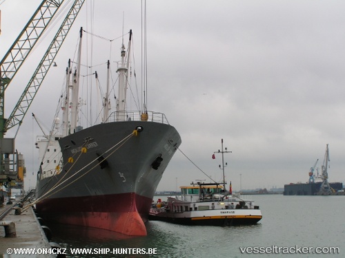
Andalucia Carrier
Current StatusWhere is the vessel?
Andalucia Carrier is currently in 90 nm E of Londolovit, based on AIS data received about 4h ago.
Latest AIS update:
Current position: 3.10167° S, 154.11166° E (90 nm E of Londolovit)
Average speed (last 7 days): Loading…
Average speed (last 30 days): Loading…
Vessel profile: Andalucia Carrier is a Refrigerated Cargo Ship with dimensions 18m x 122m.
This page combines live AIS, route history, probable destination signals, nearby traffic, and port activity for practical vessel monitoring.
The current position of vessel Andalucia Carrier is -3.10167 lat / 154.11166 lng. Updated: 2026-04-05 16:27:26 UTCNearest reference points:
- Near Rabaul
- 15 nm SW of Lambom Island
Details:
Live Vessel Andalucia Carrier Analytics (details, animations, etc.)
Recent AIS points (UTC):
2026-04-05 10:12:27 UTC · -4.46167, 153.87833 · SOG 12 kn · COG -1°2026-04-05 11:24:24 UTC · -4.20333, 153.92166 · SOG 13 kn · COG -1°
2026-04-05 13:25:18 UTC · -3.77380, 153.99446 · SOG 13.3 kn · COG 359°
2026-04-05 16:27:26 UTC · -3.10167, 154.11166 · SOG 14 kn · COG -1°