 vesseltracker.com
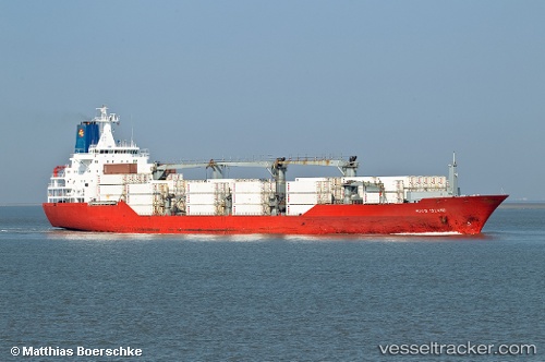
 Hood Island
Current Status
Where is the vessel?
Hood Island is currently in 55 nm NE of Tortella, based on AIS data received about 1h ago.
Latest AIS update:
Current position: 42.82865° N, 25.41763° W (55 nm NE of Tortella)
Average speed (last 7 days): Loading…
Average speed (last 30 days): Loading…
Vessel profile: Hood Island is a Refrigerated Cargo Ship with dimensions 179m x 179m.
This page combines live AIS, route history, probable destination signals, nearby traffic, and port activity for practical vessel monitoring.
The current position of vessel Hood Island is 42.82865 lat / -25.41763 lng. Updated: 2026-04-09 20:05:24 UTCCurrently sailing under the flag of Bahamas ![]()
Hood Island built in 1994 year
Deadweight:
14140 tDetails:
Live Vessel Hood Island Analytics (details, animations, etc.)
Recent AIS points (UTC):
2026-04-09 13:30:42 UTC · 42.28224, -28.03067 · SOG 18.7 kn · COG -1°2026-04-09 15:20:53 UTC · 42.45142, -27.28842 · SOG 18.5 kn · COG 71°
2026-04-09 17:29:38 UTC · 42.62996, -26.43559 · SOG 17.7 kn · COG 76°
2026-04-09 20:05:24 UTC · 42.82865, -25.41763 · SOG 17.6 kn · COG 76°