 vesseltracker.com
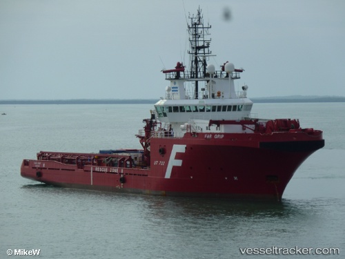
Sea Meadow 29
Current StatusWhere is the vessel?
Sea Meadow 29 is currently in 46 nm NE of Song Doc, based on AIS data received about 2h ago.
Latest AIS update:
Current position: 7.66190° N, 104.64762° E (46 nm NE of Song Doc)
Average speed (last 7 days): Loading…
Average speed (last 30 days): Loading…
Vessel profile: Sea Meadow 29 is a Offshore Tug Supply Ship with dimensions 18m x 75m.
This page combines live AIS, route history, probable destination signals, nearby traffic, and port activity for practical vessel monitoring.
The current position of vessel Sea Meadow 29 is 7.66190 lat / 104.64762 lng. Updated: 2026-04-21 18:00:22 UTCNearest reference points:
- 68 nm S of Nam Can Port
- 46 nm N of Penara Marine Terminal
- 23 nm E of Muda Marine Terminal
Details:
Live Vessel Sea Meadow 29 Analytics (details, animations, etc.)
Recent AIS points (UTC):
2026-04-21 16:28:43 UTC · 7.60744, 104.58658 · SOG 9 kn · COG 49°2026-04-21 18:00:22 UTC · 7.66190, 104.64762 · SOG 9.8 kn · COG 47°
2026-04-21 18:00:22 UTC · 7.66190, 104.64762 · SOG 9.8 kn · COG 47°
2026-04-21 18:00:22 UTC · 7.66190, 104.64762 · SOG 9.8 kn · COG 47°