 vesseltracker.com
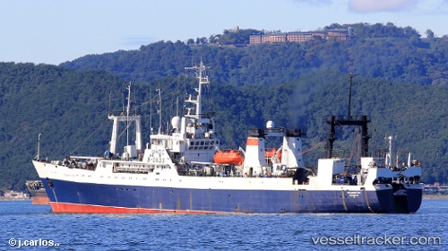
Vladivostok
Current StatusWhere is the vessel?
Vladivostok is currently in 63 nm W of Hongdo, based on AIS data received about 3h ago.
Latest AIS update:
Current position: 34.53500° N, 123.91500° E (63 nm W of Hongdo)
Average speed (last 7 days): Loading…
Average speed (last 30 days): Loading…
Vessel profile: Vladivostok is a Fishing Vessel with dimensions 16m x 103m.
This page combines live AIS, route history, probable destination signals, nearby traffic, and port activity for practical vessel monitoring.
The current position of vessel Vladivostok is 34.53500 lat / 123.91500 lng. Updated: 2026-04-21 03:26:09 UTCNearest reference points:
- 77 nm W of Hongdo
- 82 nm W of Gageohyangri
- 102 nm W of Gageohyangri
Details:
Live Vessel Vladivostok Analytics (details, animations, etc.)
Recent AIS points (UTC):
2026-04-21 01:59:06 UTC · 34.29167, 124.07500 · SOG 11 kn · COG -1°2026-04-21 03:26:09 UTC · 34.53500, 123.91500 · SOG 11 kn · COG -1°
2026-04-21 03:26:09 UTC · 34.53500, 123.91500 · SOG 11 kn · COG -1°
2026-04-21 03:26:09 UTC · 34.53500, 123.91500 · SOG 11 kn · COG -1°