 vesseltracker.com
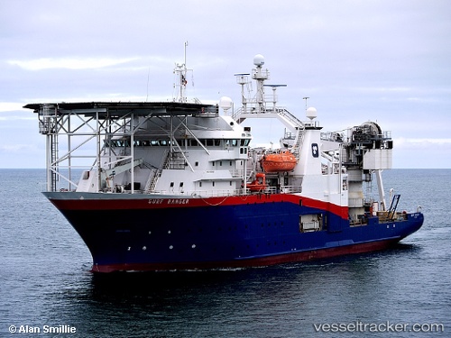
Surf Ranger
Current StatusWhere is the vessel?
Surf Ranger is currently in 26 nm W of Psará, based on AIS data received about 22d ago.
Latest AIS update:
Current position: 38.55265° N, 25.00652° E (26 nm W of Psará)
Average speed (last 7 days): Loading…
Average speed (last 30 days): Loading…
Vessel profile: Surf Ranger is a Research Vessel with dimensions 20m x 85m.
This page combines live AIS, route history, probable destination signals, nearby traffic, and port activity for practical vessel monitoring.
The current position of vessel Surf Ranger is 38.55265 lat / 25.00652 lng. Updated: 2026-03-27 23:45:03 UTCNearest reference points:
- 16 nm E of Skíros
- 28 nm NW of Psará
- 29 nm SW of Sigri Lesvou
Details:
Live Vessel Surf Ranger Analytics (details, animations, etc.)
Recent AIS points (UTC):
2026-03-27 23:45:03 UTC · 38.55265, 25.00652 · SOG 4.8 kn · COG 27°