 vesseltracker.com
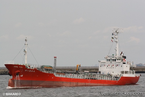
Rahmat
Current StatusWhere is the vessel?
Rahmat is currently in 40 nm NE of PENGERANG, based on AIS data received about 2h ago.
Latest AIS update:
Current position: 1.74500° N, 104.68500° E (40 nm NE of PENGERANG)
Average speed (last 7 days): Loading…
Average speed (last 30 days): Loading…
Vessel profile: Rahmat is a Oil Products Tanker with dimensions 11m x 75m.
This page combines live AIS, route history, probable destination signals, nearby traffic, and port activity for practical vessel monitoring.
The current position of vessel Rahmat is 1.74500 lat / 104.68500 lng. Updated: 2026-03-29 17:31:33 UTCNearest reference points:
- 45 nm NE of PENGERANG
- 34 nm NE of PENGERANG
- 51 nm NE of PENGERANG
Details:
Live Vessel Rahmat Analytics (details, animations, etc.)
Recent AIS points (UTC):
2026-03-29 12:22:33 UTC · 1.74500, 104.68500 · SOG 0 kn · COG -1°2026-03-29 13:31:21 UTC · 1.74615, 104.68579 · SOG 0 kn · COG -1°
2026-03-29 15:18:33 UTC · 1.74619, 104.68603 · SOG 0 kn · COG 181°
2026-03-29 17:31:33 UTC · 1.74500, 104.68500 · SOG 0 kn · COG -1°