 vesseltracker.com
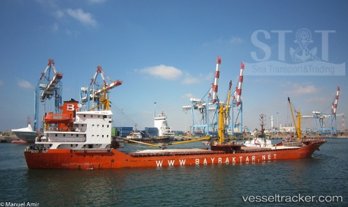
 OCEAN LEGEND
Current Status
Where is the vessel?
OCEAN LEGEND is currently in Near ZEYTINBURNU, based on AIS data received less than 1h ago.
Latest AIS update:
Current position: 40.96233° N, 28.90730° E (Near ZEYTINBURNU)
Average speed (last 7 days): Loading…
Average speed (last 30 days): Loading…
Vessel profile: OCEAN LEGEND is a General Cargo with dimensions m x m.
This page combines live AIS, route history, probable destination signals, nearby traffic, and port activity for practical vessel monitoring.
The current position of vessel OCEAN LEGEND is 40.96233 lat / 28.90730 lng. Updated: 2026-04-20 19:15:39 UTCNearest reference points:
- Near ZEYTINBURNU
- Near BAKIRKOY
- Near Davutpasa
Currently sailing under the flag of Liberia ![]()
Details:
Live Vessel OCEAN LEGEND Analytics (details, animations, etc.)
Recent AIS points (UTC):
2026-04-20 15:48:39 UTC · 40.96198, 28.90728 · SOG 0 kn · COG 285°2026-04-20 16:42:38 UTC · 40.96235, 28.90718 · SOG 0.1 kn · COG 264°
2026-04-20 17:27:39 UTC · 40.96240, 28.90723 · SOG 0.1 kn · COG 261°
2026-04-20 19:15:39 UTC · 40.96233, 28.90730 · SOG 0 kn · COG 268°