 vesseltracker.com
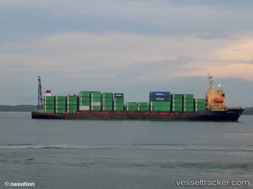
Mv.armada Permata
Current StatusWhere is the vessel?
Mv.armada Permata is currently in 36 nm E of RAHA, based on AIS data received about 5h ago.
Latest AIS update:
Current position: 4.99546° S, 123.31603° E (36 nm E of RAHA)
Average speed (last 7 days): Loading…
Average speed (last 30 days): Loading…
Vessel profile: Mv.armada Permata is a Container Ship with dimensions 25m x 130m.
This page combines live AIS, route history, probable destination signals, nearby traffic, and port activity for practical vessel monitoring.
The current position of vessel Mv.armada Permata is -4.99546 lat / 123.31603 lng. Updated: 2026-04-05 10:41:23 UTCNearest reference points:
- Near Labuan
- Near BAUBAU
- 11 nm NW of KENDARI
Details:
Live Vessel Mv.armada Permata Analytics (details, animations, etc.)
Recent AIS points (UTC):
2026-04-05 09:48:12 UTC · -5.14454, 123.31763 · SOG 10 kn · COG -1°2026-04-05 10:41:23 UTC · -4.99546, 123.31603 · SOG 9.9 kn · COG -1°
2026-04-05 10:41:23 UTC · -4.99546, 123.31603 · SOG 9.9 kn · COG -1°
2026-04-05 10:41:23 UTC · -4.99546, 123.31603 · SOG 9.9 kn · COG -1°