 vesseltracker.com
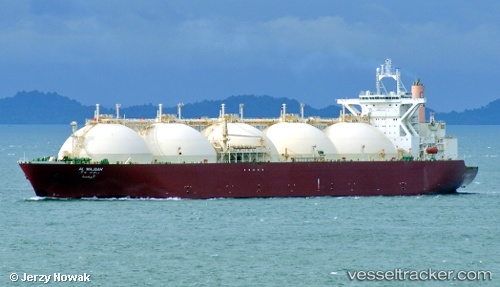
 AL WAJBAH
Current Status
Where is the vessel?
AL WAJBAH is currently in 12 nm SW of Galle, based on AIS data received less than 1h ago.
Latest AIS update:
Current position: 5.93593° N, 80.04057° E (12 nm SW of Galle)
Average speed (last 7 days): Loading…
Average speed (last 30 days): Loading…
Vessel profile: AL WAJBAH is a LNG Tanker with dimensions 298m x 46m.
This page combines live AIS, route history, probable destination signals, nearby traffic, and port activity for practical vessel monitoring.
The current position of vessel AL WAJBAH is 5.93593 lat / 80.04057 lng. Updated: 2026-04-19 23:31:58 UTCNearest reference points:
- 19 nm SW of Bataduwa
- 15 nm S of Koggala
- 38 nm SW of Galle
Currently sailing under the flag of Marshall Islands ![]()
AL WAJBAH built in 1997 year
Deadweight:
72348 tDetails:
Live Vessel AL WAJBAH Analytics (details, animations, etc.)
Recent AIS points (UTC):
2026-04-19 19:41:00 UTC · 5.93578, 80.04069 · SOG 0.1 kn · COG 124°2026-04-19 22:04:59 UTC · 5.93617, 80.04082 · SOG 0 kn · COG 142°
2026-04-19 22:04:59 UTC · 5.93617, 80.04082 · SOG 0 kn · COG 142°
2026-04-19 23:31:58 UTC · 5.93593, 80.04057 · SOG 0 kn · COG 134°