 vesseltracker.com
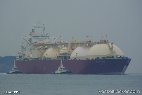
 AL ZUBARAH
Current Status
Where is the vessel?
AL ZUBARAH is currently in 20 nm E of Kikeh, based on AIS data received about 87d ago.
Latest AIS update:
Current position: 5.83972° N, 114.62057° E (20 nm E of Kikeh)
Average speed (last 7 days): Loading…
Average speed (last 30 days): Loading…
Vessel profile: AL ZUBARAH is a LNG Tanker with dimensions 298m x 46m.
This page combines live AIS, route history, probable destination signals, nearby traffic, and port activity for practical vessel monitoring.
The current position of vessel AL ZUBARAH is 5.83972 lat / 114.62057 lng. Updated: 2026-01-21 07:58:57 UTCNearest reference points:
- Near Kikeh
- 44 nm SW of Tembungo
- 53 nm S of Pulau Lang Lang
Currently sailing under the flag of Marshall Islands ![]()
AL ZUBARAH built in 1996 year
Deadweight:
72557 tDetails:
Live Vessel AL ZUBARAH Analytics (details, animations, etc.)
Recent AIS points (UTC):
2026-01-21 07:58:57 UTC · 5.83972, 114.62057 · SOG 0.7 kn · COG 154°