 vesseltracker.com
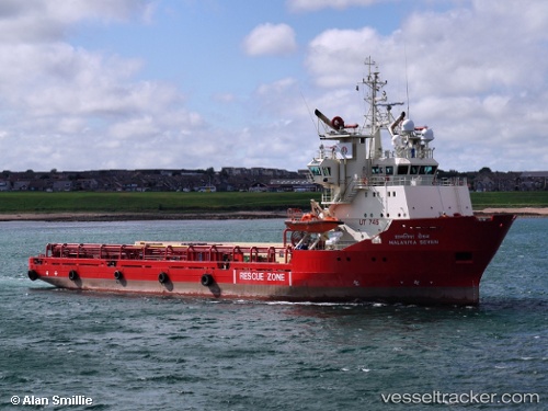
 Sartor
Current Status
Where is the vessel?
Sartor is currently in Near MIDIA, based on AIS data received about 1h ago.
Latest AIS update:
Current position: 44.34170° N, 28.68570° E (Near MIDIA)
Average speed (last 7 days): Loading…
Average speed (last 30 days): Loading…
Vessel profile: Sartor is a Offshore Tug Supply Ship with dimensions m x m.
This page combines live AIS, route history, probable destination signals, nearby traffic, and port activity for practical vessel monitoring.
The current position of vessel Sartor is 44.34170 lat / 28.68570 lng. Updated: 2026-04-07 19:32:15 UTCNearest reference points:
- Near MIDIA
- Near Constanta
- Near Ovidiu
Currently sailing under the flag of Panama ![]()
Sartor built in 1994 year
Deadweight:
4568 tDetails:
Live Vessel Sartor Analytics (details, animations, etc.)
Recent AIS points (UTC):
2026-04-07 14:13:54 UTC · 44.14147, 29.27789 · SOG 10 kn · COG -1°2026-04-07 15:51:15 UTC · 44.21477, 28.89264 · SOG 10.6 kn · COG 292°
2026-04-07 17:42:58 UTC · 44.34170, 28.68570 · SOG 0 kn · COG 184°
2026-04-07 19:32:15 UTC · 44.34170, 28.68570 · SOG 0 kn · COG 184°