 vesseltracker.com
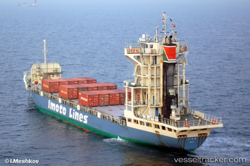
 Ikuta
Ikuta
Current Status
Where is the vessel?
Ikuta is currently in Near Tomakomai, based on AIS data received about 12h ago.
Latest AIS update:
Current position: 42.63489° N, 141.62466° E (Near Tomakomai)
Average speed (last 7 days): Loading…
Average speed (last 30 days): Loading…
Vessel profile: Ikuta is a Container Ship with dimensions 96m x 14m.
This page combines live AIS, route history, probable destination signals, nearby traffic, and port activity for practical vessel monitoring.
The current position of vessel Ikuta is 42.63489 lat / 141.62466 lng. Updated: 2026-04-18 22:26:05 UTCNearest reference points:
- Near Muroran
- 23 nm NE of SAI
- 11 nm NW of Yokohama, Aomori
Currently sailing under the flag of Japan ![]()
Ikuta built in 2006 year
Deadweight:
1830 tDetails:
Live Vessel Ikuta Analytics (details, animations, etc.)
Recent AIS points (UTC):
2026-04-18 18:42:15 UTC · 42.59859, 141.59610 · SOG 0.2 kn · COG 243°2026-04-18 22:26:05 UTC · 42.63489, 141.62466 · SOG 0.1 kn · COG 181°
2026-04-18 22:26:05 UTC · 42.63489, 141.62466 · SOG 0.1 kn · COG 181°
2026-04-18 22:26:05 UTC · 42.63489, 141.62466 · SOG 0.1 kn · COG 181°