 vesseltracker.com
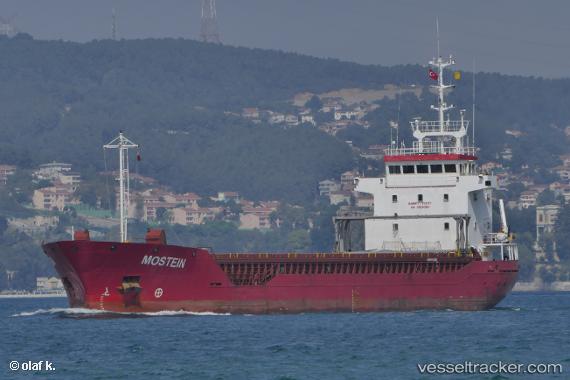
 MOSTEIN
Current Status
Where is the vessel?
MOSTEIN is currently in Near Marina di Ravenna, based on AIS data received about 1d ago.
Latest AIS update:
Current position: 44.46680° N, 12.25529° E (Near Marina di Ravenna)
Average speed (last 7 days): Loading…
Average speed (last 30 days): Loading…
Vessel profile: MOSTEIN is a General Cargo with dimensions m x m.
This page combines live AIS, route history, probable destination signals, nearby traffic, and port activity for practical vessel monitoring.
The current position of vessel MOSTEIN is 44.46680 lat / 12.25529 lng. Updated: 2026-04-10 07:21:39 UTCNearest reference points:
- Near Marina di Ravenna
- Near Porto San Vitale
- Near San Giuseppe
Currently sailing under the flag of Barbados ![]()
Details:
Live Vessel MOSTEIN Analytics (details, animations, etc.)
Recent AIS points (UTC):
2026-04-10 02:22:38 UTC · 44.46686, 12.25525 · SOG 0 kn · COG -1°2026-04-10 03:49:55 UTC · 44.46667, 12.25500 · SOG 0 kn · COG -1°
2026-04-10 05:57:36 UTC · 44.46689, 12.25529 · SOG 0 kn · COG 212°
2026-04-10 07:21:39 UTC · 44.46680, 12.25529 · SOG 0 kn · COG 212°