 vesseltracker.com
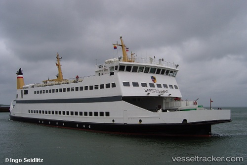
 Nordfriesland
Current Status
Where is the vessel?
Nordfriesland is currently in Near Langeness, based on AIS data received less than 1h ago.
Latest AIS update:
Current position: 54.68427° N, 8.61731° E (Near Langeness)
Average speed (last 7 days): Loading…
Average speed (last 30 days): Loading…
Vessel profile: Nordfriesland is a Passenger Ro Ro Cargo Ship with dimensions 67m x 67m.
This page combines live AIS, route history, probable destination signals, nearby traffic, and port activity for practical vessel monitoring.
The current position of vessel Nordfriesland is 54.68427 lat / 8.61731 lng. Updated: 2026-04-01 04:11:21 UTCNearest reference points:
- Near BUESUM
- Near Basel
- Near Esbjerg
Currently sailing under the flag of Germany ![]()
Nordfriesland built in 1995 year
Deadweight:
370 tDetails:
Live Vessel Nordfriesland Analytics (details, animations, etc.)
Recent AIS points (UTC):
2026-03-31 22:21:41 UTC · 54.69291, 8.57665 · SOG 0 kn · COG 90°2026-03-31 23:48:40 UTC · 54.69290, 8.57667 · SOG 0 kn · COG 90°
2026-04-01 02:21:39 UTC · 54.69293, 8.57664 · SOG 0 kn · COG 90°
2026-04-01 04:11:21 UTC · 54.68427, 8.61731 · SOG 8.9 kn · COG 14°