 vesseltracker.com
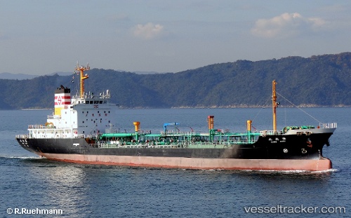
 ANGEL 118
Current Status
Where is the vessel?
ANGEL 118 is currently in 131 nm SW of Sorol Atoll, based on AIS data received about 1h ago.
Latest AIS update:
Current position: 7.26617° N, 138.35767° E (131 nm SW of Sorol Atoll)
Average speed (last 7 days): Loading…
Average speed (last 30 days): Loading…
Vessel profile: ANGEL 118 is a Oil Products Tanker with dimensions 15m x 98m.
This page combines live AIS, route history, probable destination signals, nearby traffic, and port activity for practical vessel monitoring.
The current position of vessel ANGEL 118 is 7.26617 lat / 138.35767 lng. Updated: 2026-04-16 23:47:06 UTCCurrently sailing under the flag of Panama ![]()
ANGEL 118 built in 1994 year
Deadweight:
4991 tDetails:
Live Vessel ANGEL 118 Analytics (details, animations, etc.)
Recent AIS points (UTC):
2026-04-16 16:06:04 UTC · 6.81450, 139.43900 · SOG 9.3 kn · COG 296°2026-04-16 19:10:12 UTC · 6.99450, 139.01151 · SOG 8.7 kn · COG 296°
2026-04-16 21:31:56 UTC · 7.12883, 138.68083 · SOG 9.2 kn · COG 296°
2026-04-16 23:47:06 UTC · 7.26617, 138.35767 · SOG 9.3 kn · COG 295°