 vesseltracker.com
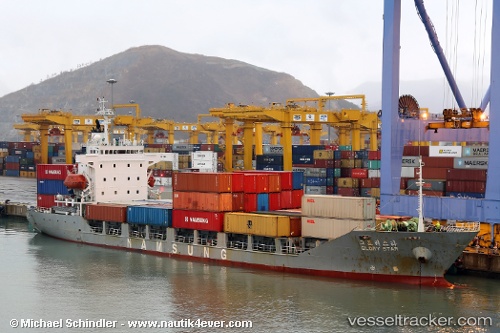
 Glory Star
Current Status
Where is the vessel?
Glory Star is currently in Near Incheon, based on AIS data received about 240d ago.
Latest AIS update:
Current position: 37.45647° N, 126.60597° E (Near Incheon)
Average speed (last 7 days): Loading…
Average speed (last 30 days): Loading…
Vessel profile: Glory Star is a Container Ship with dimensions 106m x 17m.
This page combines live AIS, route history, probable destination signals, nearby traffic, and port activity for practical vessel monitoring.
The current position of vessel Glory Star is 37.45647 lat / 126.60597 lng. Updated: 2025-08-21 01:07:47 UTCNearest reference points:
- Near Incheon
- Near Gyeongin
- 14 nm SW of Incheon
Currently sailing under the flag of Palau ![]()
Glory Star built in 1994 year
Deadweight:
5981 tDetails:
Live Vessel Glory Star Analytics (details, animations, etc.)
Recent AIS points (UTC):
2025-08-21 01:07:47 UTC · 37.45647, 126.60597 · SOG 0.2 kn · COG -1°