 vesseltracker.com
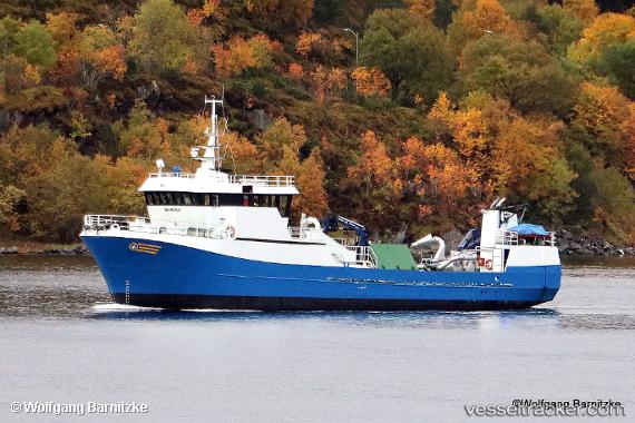
 Havoern
Current Status
Where is the vessel?
Havoern is currently in Near Kristiansund, based on AIS data received about 1h ago.
Latest AIS update:
Current position: 63.11305° N, 7.73281° E (Near Kristiansund)
Average speed (last 7 days): Loading…
Average speed (last 30 days): Loading…
Vessel profile: Havoern is a Fish Carrier with dimensions 43m x 8m.
This page combines live AIS, route history, probable destination signals, nearby traffic, and port activity for practical vessel monitoring.
The current position of vessel Havoern is 63.11305 lat / 7.73281 lng. Updated: 2026-03-28 13:59:58 UTCNearest reference points:
- Near Kristiansund
- Near Smøla
- Near Halsa
Currently sailing under the flag of Norway ![]()
Havoern built in 1994 year
Deadweight:
350 tDetails:
Live Vessel Havoern Analytics (details, animations, etc.)
Recent AIS points (UTC):
2026-03-28 07:25:39 UTC · 63.11302, 7.73281 · SOG 0 kn · COG 175°2026-03-28 09:38:10 UTC · 63.11306, 7.73283 · SOG 0 kn · COG 173°
2026-03-28 12:33:19 UTC · 63.11304, 7.73279 · SOG 0 kn · COG 173°
2026-03-28 13:59:58 UTC · 63.11305, 7.73281 · SOG 0 kn · COG 173°