 vesseltracker.com
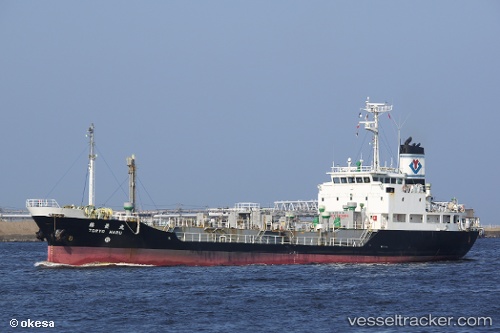
 Toryo Maru
Current Status
Where is the vessel?
Toryo Maru is currently in 58 nm SE of Geomundo, based on AIS data received about 1h ago.
Latest AIS update:
Current position: 33.39385° N, 128.18266° E (58 nm SE of Geomundo)
Average speed (last 7 days): Loading…
Average speed (last 30 days): Loading…
Vessel profile: Toryo Maru is a Chemical Tanker with dimensions 69m x 69m.
This page combines live AIS, route history, probable destination signals, nearby traffic, and port activity for practical vessel monitoring.
The current position of vessel Toryo Maru is 33.39385 lat / 128.18266 lng. Updated: 2026-03-26 16:00:15 UTCNearest reference points:
- 35 nm E of Geomundo
- 25 nm S of Kukdo
- 33 nm W of IZUHARA
Currently sailing under the flag of Japan ![]()
Details:
Live Vessel Toryo Maru Analytics (details, animations, etc.)
Recent AIS points (UTC):
2026-03-26 10:09:35 UTC · 33.42331, 128.14758 · SOG 0.4 kn · COG 37°2026-03-26 11:29:25 UTC · 33.41457, 128.15585 · SOG 0.5 kn · COG 16°
2026-03-26 14:18:26 UTC · 33.40175, 128.17416 · SOG 0.4 kn · COG 358°
2026-03-26 16:00:15 UTC · 33.39385, 128.18266 · SOG 0.4 kn · COG 5°