 vesseltracker.com
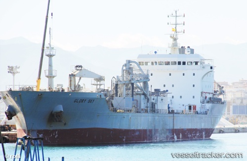
 Glory Sky
Current Status
Where is the vessel?
Glory Sky is currently in 174 nm NW of Apra, based on AIS data received about 2h ago.
Latest AIS update:
Current position: 14.80067° N, 141.97342° E (174 nm NW of Apra)
Average speed (last 7 days): Loading…
Average speed (last 30 days): Loading…
Vessel profile: Glory Sky is a Cement Carrier with dimensions 145m x 22m.
This page combines live AIS, route history, probable destination signals, nearby traffic, and port activity for practical vessel monitoring.
The current position of vessel Glory Sky is 14.80067 lat / 141.97342 lng. Updated: 2026-03-26 05:41:08 UTCCurrently sailing under the flag of Panama ![]()
Glory Sky built in 1996 year
Deadweight:
16265 tDetails:
Live Vessel Glory Sky Analytics (details, animations, etc.)
Recent AIS points (UTC):
2026-03-26 00:00:02 UTC · 15.24353, 141.11147 · SOG 9.9 kn · COG 117°2026-03-26 01:41:33 UTC · 15.11446, 141.36519 · SOG 9.9 kn · COG 118°
2026-03-26 03:48:19 UTC · 14.95173, 141.68555 · SOG 10.1 kn · COG 118°
2026-03-26 05:41:08 UTC · 14.80067, 141.97342 · SOG 10 kn · COG 116°