 vesseltracker.com
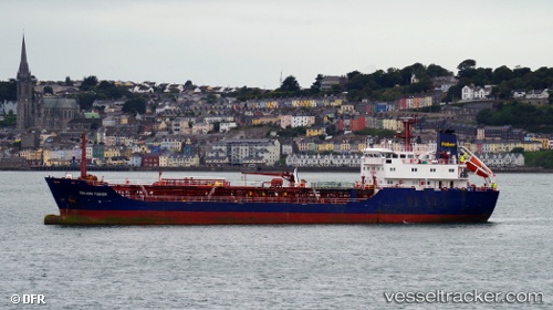
 ENDO SIROCCO
Current Status
Where is the vessel?
ENDO SIROCCO is currently in 16 nm S of Capulo, based on AIS data received less than 1h ago.
Latest AIS update:
Current position: 8.23333° S, 13.06833° E (16 nm S of Capulo)
Average speed (last 7 days): Loading…
Average speed (last 30 days): Loading…
Vessel profile: ENDO SIROCCO is a Oil Products Tanker with dimensions 15m x 91m.
This page combines live AIS, route history, probable destination signals, nearby traffic, and port activity for practical vessel monitoring.
The current position of vessel ENDO SIROCCO is -8.23333 lat / 13.06833 lng. Updated: 2026-04-18 07:51:08 UTCNearest reference points:
- Near Luanda
- Near Greater Plutonio
- Near SOYO
Currently sailing under the flag of Cyprus ![]()
ENDO SIROCCO built in 1997 year
Deadweight:
4967 tDetails:
Live Vessel ENDO SIROCCO Analytics (details, animations, etc.)
Recent AIS points (UTC):
2026-04-18 02:32:14 UTC · -8.23450, 13.07033 · SOG 0 kn · COG -1°2026-04-18 03:44:17 UTC · -8.23450, 13.07017 · SOG 0 kn · COG -1°
2026-04-18 06:09:12 UTC · -8.23333, 13.06833 · SOG 0 kn · COG -1°
2026-04-18 07:51:08 UTC · -8.23333, 13.06833 · SOG 0 kn · COG -1°