 vesseltracker.com
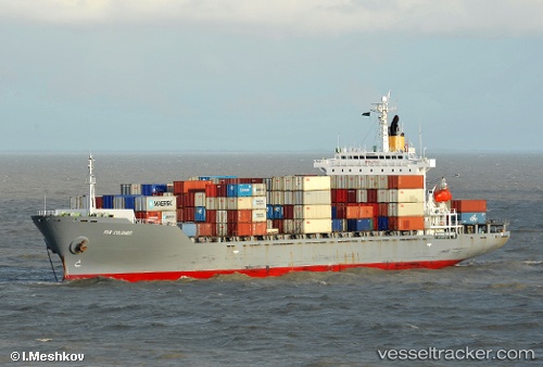
 Tanto Pratama
Current Status
Where is the vessel?
Tanto Pratama is currently in 27 nm N of Kualamandah, based on AIS data received about 1h ago.
Latest AIS update:
Current position: 0.06998° S, 103.98456° E (27 nm N of Kualamandah)
Average speed (last 7 days): Loading…
Average speed (last 30 days): Loading…
Vessel profile: Tanto Pratama is a Container Ship with dimensions 182m x 28m.
This page combines live AIS, route history, probable destination signals, nearby traffic, and port activity for practical vessel monitoring.
The current position of vessel Tanto Pratama is -0.06998 lat / 103.98456 lng. Updated: 2026-04-17 22:37:24 UTCNearest reference points:
- 16 nm E of Kualamandah
- 19 nm SW of TANJUNG PINANG
- Near Jabung Terminal
Currently sailing under the flag of Indonesia ![]()
Details:
Live Vessel Tanto Pratama Analytics (details, animations, etc.)
Recent AIS points (UTC):
2026-04-17 17:23:24 UTC · -0.84478, 104.28818 · SOG 10.4 kn · COG -1°2026-04-17 18:50:44 UTC · -0.64068, 104.17141 · SOG 9.1 kn · COG -1°
2026-04-17 18:50:44 UTC · -0.64068, 104.17141 · SOG 9.1 kn · COG -1°
2026-04-17 22:37:24 UTC · -0.06998, 103.98456 · SOG 10.8 kn · COG -1°