 vesseltracker.com
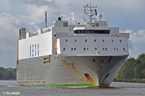
Vessel Bore Bay IMO: 9122007, MMSI: 230357000 Ro Ro Cargo Ship
UTC, 52.52611, 3.87059, course: 195, speed: 12.1
UTC, 52.13748, 3.76668, course: 182, speed: 12.7
2026-02-26 13:25:54 UTC, 51.96354, 4.14547, course: 131, speed: 12
Live AIS position:
UTC. Near HOEK VAN HOLLAND),
updated 2026-02-26 13:25:54 UTC.
Find the position of the vessel Bore Bay on the map. The latter are known coordinates and path.
marine traffic ship tracker show on live map
The current position of vessel Bore Bay is 51.96354 lat / 4.14547 lng. Updated: 2026-02-26 13:25:54 UTCCurrently sailing under the flag of Finland
Bore Bay built in 1997 year
Deadweight:
6077 tDetails:
Last coordinates of the vessel:
UTC, 52.98560, 4.08938, course: 229, speed: 12.4UTC, 52.52611, 3.87059, course: 195, speed: 12.1
UTC, 52.13748, 3.76668, course: 182, speed: 12.7
2026-02-26 13:25:54 UTC, 51.96354, 4.14547, course: 131, speed: 12