 vesseltracker.com
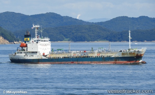
Miracle Road
Current StatusWhere is the vessel?
Miracle Road is currently in Near YALOVA, based on AIS data received about 1000d ago.
Latest AIS update:
Current position: 40.72425° N, 29.48726° E (Near YALOVA)
Average speed (last 7 days): Loading…
Average speed (last 30 days): Loading…
Vessel profile: Miracle Road is a Lpg Tanker with dimensions 15m x 96m.
This page combines live AIS, route history, probable destination signals, nearby traffic, and port activity for practical vessel monitoring.
The current position of vessel Miracle Road is 40.72425 lat / 29.48726 lng. Updated: 2023-07-10 21:45:12 UTCNearest reference points:
- Near YALOVA
- Near Yilport
- Near Diliskelesi
Details:
Live Vessel Miracle Road Analytics (details, animations, etc.)
Recent AIS points (UTC):
2023-07-10 21:45:12 UTC · 40.72425, 29.48726 · SOG 0 kn · COG 334°