 vesseltracker.com
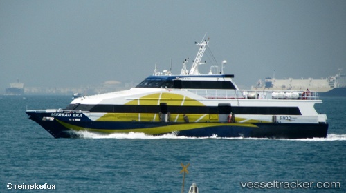
Merbau Era
Current StatusWhere is the vessel?
Merbau Era is currently in Near KABIL, based on AIS data received about 86d ago.
Latest AIS update:
Current position: 1.14486° N, 104.17569° E (Near KABIL)
Average speed (last 7 days): Loading…
Average speed (last 30 days): Loading…
Vessel profile: Merbau Era is a Passenger Ship with dimensions 6m x 42m.
This page combines live AIS, route history, probable destination signals, nearby traffic, and port activity for practical vessel monitoring.
The current position of vessel Merbau Era is 1.14486 lat / 104.17569 lng. Updated: 2026-01-21 08:52:28 UTCNearest reference points:
- Near KABIL
- Near BATU AMPAR
- Near TANAH MERAH
Details:
Live Vessel Merbau Era Analytics (details, animations, etc.)
Recent AIS points (UTC):
2026-01-21 08:52:28 UTC · 1.14486, 104.17569 · SOG 21.2 kn · COG -1°