 vesseltracker.com
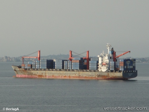
 Wan Fu Da
Current Status
Where is the vessel?
Wan Fu Da is currently in Open sea, approx. 457 nm off the nearest listed port, based on AIS data received less than 1h ago.
Latest AIS update:
Current position: 12.02110° N, 60.83869° E (Open sea, approx. 457 nm off the nearest listed port)
Average speed (last 7 days): Loading…
Average speed (last 30 days): Loading…
Vessel profile: Wan Fu Da is a Container Ship with dimensions 205m x 27m.
This page combines live AIS, route history, probable destination signals, nearby traffic, and port activity for practical vessel monitoring.
The current position of vessel Wan Fu Da is 12.02110 lat / 60.83869 lng. Updated: 2026-03-29 17:50:41 UTCNearest reference points:
- Open sea, approx. 457 nm off the nearest listed port
- Open sea, approx. 456 nm off the nearest listed port
- Open sea (no nearby ports in database)
Currently sailing under the flag of China ![]()
Wan Fu Da built in 1997 year
Deadweight:
28293 tDetails:
Live Vessel Wan Fu Da Analytics (details, animations, etc.)
Recent AIS points (UTC):
2026-03-29 11:40:42 UTC · 12.45708, 59.37097 · SOG 14.7 kn · COG 106°2026-03-29 14:03:45 UTC · 12.27500, 59.93667 · SOG 14 kn · COG -1°
2026-03-29 15:45:41 UTC · 12.16316, 60.34010 · SOG 14.8 kn · COG 103°
2026-03-29 17:50:41 UTC · 12.02110, 60.83869 · SOG 14.8 kn · COG 105°