 vesseltracker.com
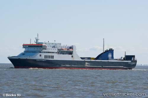
 PAN LILY
Current Status
Where is the vessel?
PAN LILY is currently in Near SAFAGA, based on AIS data received about 1h ago.
Latest AIS update:
Current position: 26.74500° N, 33.94833° E (Near SAFAGA)
Average speed (last 7 days): Loading…
Average speed (last 30 days): Loading…
Vessel profile: PAN LILY is a Ro-Ro/Passenger Ship with dimensions m x m.
This page combines live AIS, route history, probable destination signals, nearby traffic, and port activity for practical vessel monitoring.
The current position of vessel PAN LILY is 26.74500 lat / 33.94833 lng. Updated: 2026-04-18 17:46:42 UTCNearest reference points:
- Near Bur Safaga
- Near El-Guna (El Gouna)
- 19 nm SE of Zeit Bay
Currently sailing under the flag of Panama ![]()
Details:
Live Vessel PAN LILY Analytics (details, animations, etc.)
Recent AIS points (UTC):
2026-04-18 11:52:40 UTC · 26.74534, 33.94912 · SOG 0 kn · COG 141°2026-04-18 13:55:42 UTC · 26.74535, 33.94911 · SOG 0 kn · COG 142°
2026-04-18 16:25:41 UTC · 26.74535, 33.94913 · SOG 0 kn · COG 141°
2026-04-18 17:46:42 UTC · 26.74500, 33.94833 · SOG 0 kn · COG -1°