 vesseltracker.com
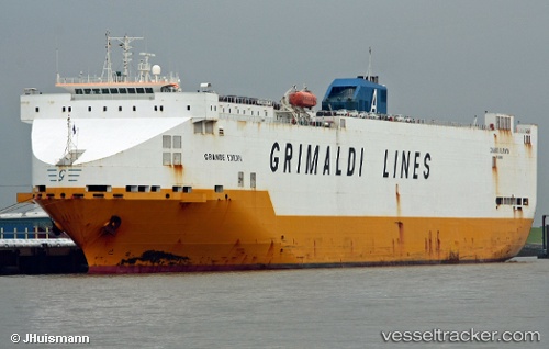
Vessel Grande Europa IMO: 9138381, MMSI: 247206000 Vehicles Carrier
UTC, 34.65726, 26.42966, course: 91, speed: 15.7
UTC, 34.65726, 26.42966, course: 91, speed: 15.7
2026-01-15 06:20:25 UTC, 34.65726, 26.42966, course: 91, speed: 15.7
Live AIS position:
UTC. 25 nm SE of Atherinolakos Ierapetras),
updated 2026-01-15 06:20:25 UTC.
Find the position of the vessel Grande Europa on the map. The latter are known coordinates and path.
marine traffic ship tracker show on live map
The current position of vessel Grande Europa is 34.65726 lat / 26.42966 lng. Updated: 2026-01-15 06:20:25 UTCCurrently sailing under the flag of Italy
Grande Europa built in 1998 year
Deadweight:
18461 tDetails:
Last coordinates of the vessel:
UTC, 34.64824, 26.05320, course: 88, speed: 16UTC, 34.65726, 26.42966, course: 91, speed: 15.7
UTC, 34.65726, 26.42966, course: 91, speed: 15.7
2026-01-15 06:20:25 UTC, 34.65726, 26.42966, course: 91, speed: 15.7