 vesseltracker.com
 Lucent
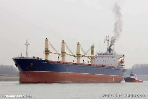
Current Status
Where is the vessel?
Lucent is currently in Near Al Adabiyah, based on AIS data received about 3h ago.
Latest AIS update:
Current position: 29.84522° N, 32.52453° E (Near Al Adabiyah)
Average speed (last 7 days): Loading…
Average speed (last 30 days): Loading…
Vessel profile: Lucent is a Bulk Carrier with dimensions 189m x 32m.
This page combines live AIS, route history, probable destination signals, nearby traffic, and port activity for practical vessel monitoring.
The current position of vessel Lucent is 29.84522 lat / 32.52453 lng. Updated: 2026-04-19 12:23:33 UTCNearest reference points:
- Near Bur Ibrahim
- Near AL ADABIYAH
- Near SUEZ PORT
Currently sailing under the flag of Panama ![]()
Lucent built in 1997 year
Deadweight:
46609 tDetails:
Live Vessel Lucent Analytics (details, animations, etc.)
Recent AIS points (UTC):
2026-04-19 10:42:32 UTC · 29.56500, 32.58667 · SOG 12 kn · COG -1°2026-04-19 12:23:33 UTC · 29.84522, 32.52453 · SOG 5.6 kn · COG 37°
2026-04-19 12:23:33 UTC · 29.84522, 32.52453 · SOG 5.6 kn · COG 37°
2026-04-19 12:23:33 UTC · 29.84522, 32.52453 · SOG 5.6 kn · COG 37°