 vesseltracker.com
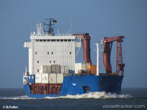
 Yakoot
Current Status
Where is the vessel?
Yakoot is currently in Near Annaba, based on AIS data received less than 1h ago.
Latest AIS update:
Current position: 36.89730° N, 7.76607° E (Near Annaba)
Average speed (last 7 days): Loading…
Average speed (last 30 days): Loading…
Vessel profile: Yakoot is a Multi Purpose Carrier with dimensions 101m x 17m.
This page combines live AIS, route history, probable destination signals, nearby traffic, and port activity for practical vessel monitoring.
The current position of vessel Yakoot is 36.89730 lat / 7.76607 lng. Updated: 2026-04-05 08:07:12 UTCNearest reference points:
- Near Annaba
- Near Skikid
- 35 nm S of Setubal
Currently sailing under the flag of Panama ![]()
Yakoot built in 1997 year
Deadweight:
4766 tDetails:
Live Vessel Yakoot Analytics (details, animations, etc.)
Recent AIS points (UTC):
2026-04-05 01:48:24 UTC · 36.89730, 7.76609 · SOG 0 kn · COG 179°2026-04-05 04:00:32 UTC · 36.89729, 7.76607 · SOG 0 kn · COG 179°
2026-04-05 06:17:53 UTC · 36.89731, 7.76610 · SOG 0 kn · COG 179°
2026-04-05 08:07:12 UTC · 36.89730, 7.76607 · SOG 0 kn · COG 179°