 vesseltracker.com
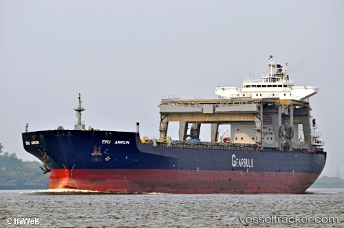
 Emu Arrow
Current Status
Where is the vessel?
Emu Arrow is currently in Near Port Moresby, based on AIS data received about 1h ago.
Latest AIS update:
Current position: 9.47124° S, 147.13718° E (Near Port Moresby)
Average speed (last 7 days): Loading…
Average speed (last 30 days): Loading…
Vessel profile: Emu Arrow is a Multi Purpose Carrier with dimensions 200m x 32m.
This page combines live AIS, route history, probable destination signals, nearby traffic, and port activity for practical vessel monitoring.
The current position of vessel Emu Arrow is -9.47124 lat / 147.13718 lng. Updated: 2026-04-01 21:44:30 UTCCurrently sailing under the flag of Bahamas ![]()
Emu Arrow built in 1997 year
Deadweight:
55457 tDetails:
Live Vessel Emu Arrow Analytics (details, animations, etc.)
Recent AIS points (UTC):
2026-04-01 15:23:47 UTC · -9.47040, 147.13562 · SOG 0 kn · COG -1°2026-04-01 17:34:01 UTC · -9.47114, 147.13750 · SOG 0 kn · COG -1°
2026-04-01 19:19:13 UTC · -9.47111, 147.13638 · SOG 0 kn · COG -1°
2026-04-01 21:44:30 UTC · -9.47124, 147.13718 · SOG 0 kn · COG -1°