 vesseltracker.com
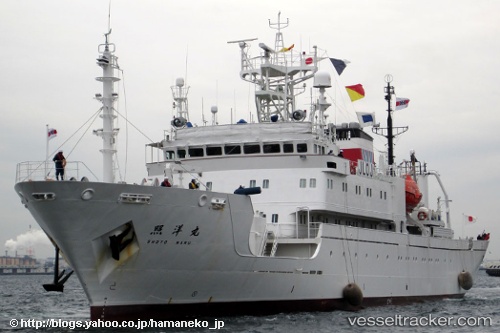
 Shoyo Maru
Current Status
Where is the vessel?
Shoyo Maru is currently in Near SAKAI, based on AIS data received about 1h ago.
Latest AIS update:
Current position: 34.60359° N, 135.30286° E (Near SAKAI)
Average speed (last 7 days): Loading…
Average speed (last 30 days): Loading…
Vessel profile: Shoyo Maru is a Fishing Vessel with dimensions 88m x 87m.
This page combines live AIS, route history, probable destination signals, nearby traffic, and port activity for practical vessel monitoring.
The current position of vessel Shoyo Maru is 34.60359 lat / 135.30286 lng. Updated: 2026-04-19 07:54:22 UTCNearest reference points:
- Near Nada-Ku, Hyogo
- Near Kobe
- Near SAKAI
Currently sailing under the flag of Japan ![]()
Details:
Live Vessel Shoyo Maru Analytics (details, animations, etc.)
Recent AIS points (UTC):
2026-04-19 02:06:29 UTC · 34.60345, 135.30177 · SOG 0 kn · COG 58°2026-04-19 03:51:30 UTC · 34.60351, 135.30284 · SOG 0 kn · COG 287°
2026-04-19 06:00:24 UTC · 34.60363, 135.30286 · SOG 0.1 kn · COG 277°
2026-04-19 07:54:22 UTC · 34.60359, 135.30286 · SOG 0.1 kn · COG 270°