 vesseltracker.com
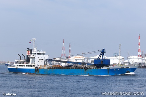
 Tenkaku
Current Status
Where is the vessel?
Tenkaku is currently in Near Muroran, based on AIS data received about 16h ago.
Latest AIS update:
Current position: 42.36833° N, 140.92166° E (Near Muroran)
Average speed (last 7 days): Loading…
Average speed (last 30 days): Loading…
Vessel profile: Tenkaku is a General Cargo Ship with dimensions 80m x 14m.
This page combines live AIS, route history, probable destination signals, nearby traffic, and port activity for practical vessel monitoring.
The current position of vessel Tenkaku is 42.36833 lat / 140.92166 lng. Updated: 2026-04-19 00:15:38 UTCNearest reference points:
- Near Muroran
- 23 nm NE of SAI
- 11 nm NW of Yokohama, Aomori
Currently sailing under the flag of Japan ![]()
Details:
Live Vessel Tenkaku Analytics (details, animations, etc.)
Recent AIS points (UTC):
2026-04-15 23:21:16 UTC · 42.36833, 140.92166 · SOG 0 kn · COG -1°2026-04-15 23:21:16 UTC · 42.36833, 140.92166 · SOG 0 kn · COG -1°
2026-04-19 00:15:38 UTC · 42.36833, 140.92166 · SOG 0 kn · COG -1°
2026-04-19 00:15:38 UTC · 42.36833, 140.92166 · SOG 0 kn · COG -1°