 vesseltracker.com
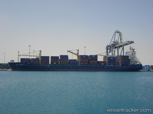
 Msc Capri
Current Status
Where is the vessel?
Msc Capri is currently in 78 nm SW of Bubaque, based on AIS data received less than 1h ago.
Latest AIS update:
Current position: 10.61450° N, 16.96133° W (78 nm SW of Bubaque)
Average speed (last 7 days): Loading…
Average speed (last 30 days): Loading…
Vessel profile: Msc Capri is a Container Ship with dimensions 208m x 29m.
This page combines live AIS, route history, probable destination signals, nearby traffic, and port activity for practical vessel monitoring.
The current position of vessel Msc Capri is 10.61450 lat / -16.96133 lng. Updated: 2026-04-03 07:26:46 UTCNearest reference points:
- 144 nm SW of Bubaque
- 97 nm SW of Port de Boké
- 48 nm W of Cap Skiring
Currently sailing under the flag of Liberia ![]()
Msc Capri built in 1998 year
Deadweight:
34051 tDetails:
Live Vessel Msc Capri Analytics (details, animations, etc.)
Recent AIS points (UTC):
2026-04-03 02:19:46 UTC · 9.68617, -16.31233 · SOG 13 kn · COG 325°2026-04-03 03:28:36 UTC · 9.89050, -16.46333 · SOG 13.4 kn · COG 329°
2026-04-03 05:32:17 UTC · 10.26767, -16.71450 · SOG 13 kn · COG 325°
2026-04-03 07:26:46 UTC · 10.61450, -16.96133 · SOG 13.3 kn · COG 327°