 vesseltracker.com
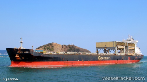
Merlin Arrow
Current StatusWhere is the vessel?
Merlin Arrow is currently in Near Point Roberts, based on AIS data received about 1h ago.
Latest AIS update:
Current position: 48.92180° N, 123.13049° W (Near Point Roberts)
Average speed (last 7 days): Loading…
Average speed (last 30 days): Loading…
Vessel profile: Merlin Arrow is a Multi Purpose Carrier with dimensions 32m x 200m.
This page combines live AIS, route history, probable destination signals, nearby traffic, and port activity for practical vessel monitoring.
The current position of vessel Merlin Arrow is 48.92180 lat / -123.13049 lng. Updated: 2026-04-12 11:37:13 UTCNearest reference points:
- Near STEVESTON
- Near Robert's Bank
- Near White Rock
Details:
Live Vessel Merlin Arrow Analytics (details, animations, etc.)
Recent AIS points (UTC):
2026-04-12 06:54:29 UTC · 48.22066, -123.43107 · SOG 4.6 kn · COG 320°2026-04-12 07:51:38 UTC · 48.29838, -123.41642 · SOG 6.6 kn · COG 2°
2026-04-12 10:25:01 UTC · 48.72779, -123.14848 · SOG 14.6 kn · COG 61°
2026-04-12 11:37:13 UTC · 48.92180, -123.13049 · SOG 13.7 kn · COG 316°